Skip to content
LandSight
About
Portfolio
Projects
Contact
Portfolio — Preservation Planning
About
Portfolio
Projects
Contact
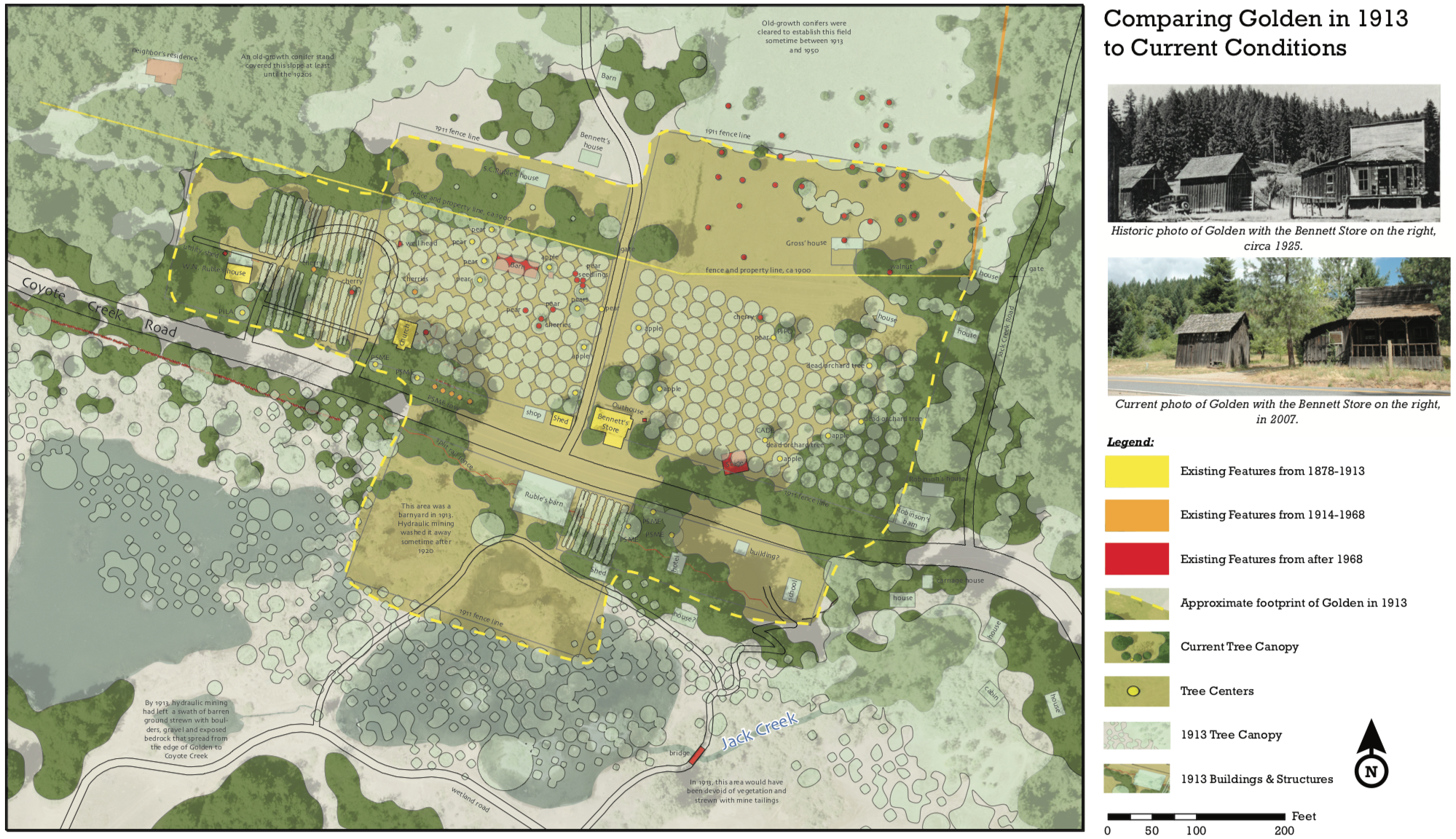
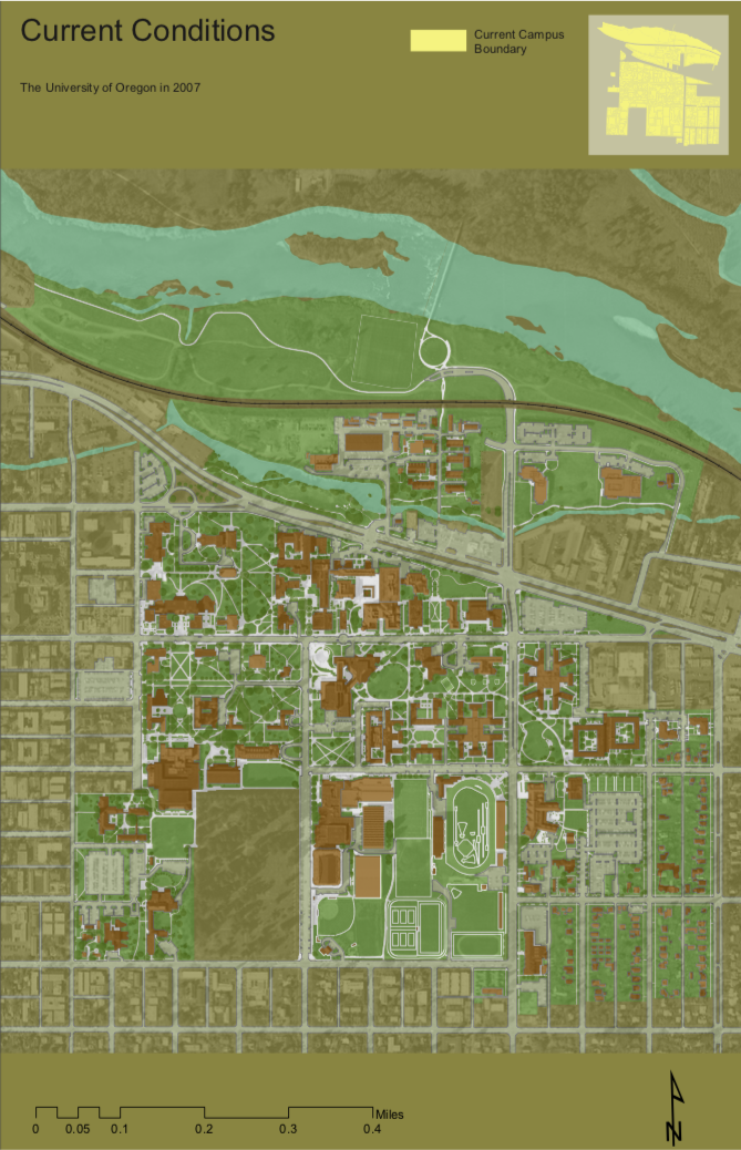
Using GIS overlays to compare past & present
Redrawing historical sites with new information
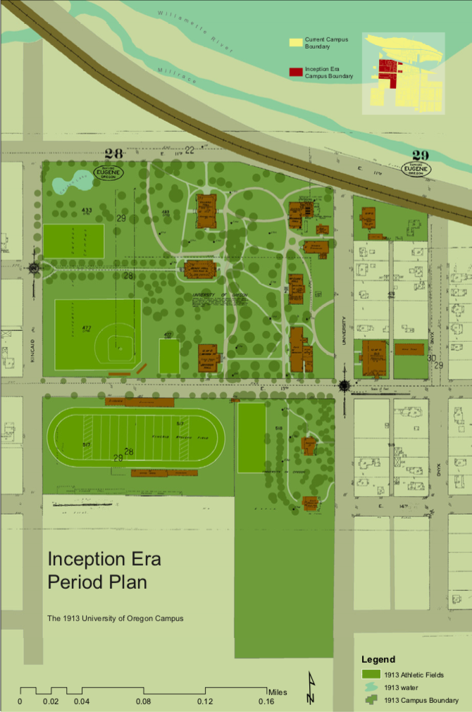
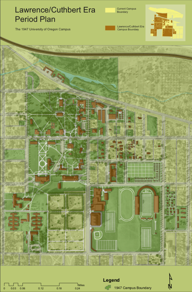
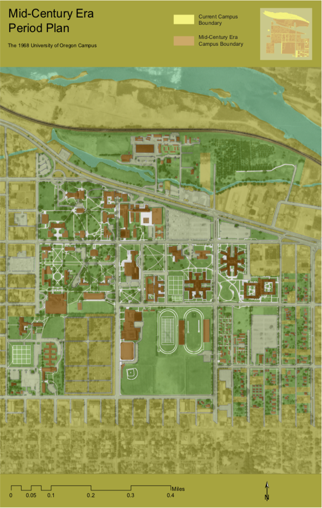
Reconstructing period plans for historical comparison
Using GIS to rectify historical photos
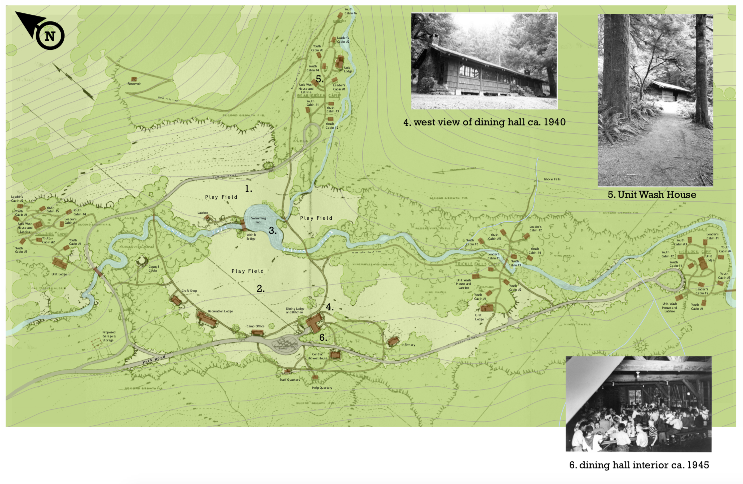
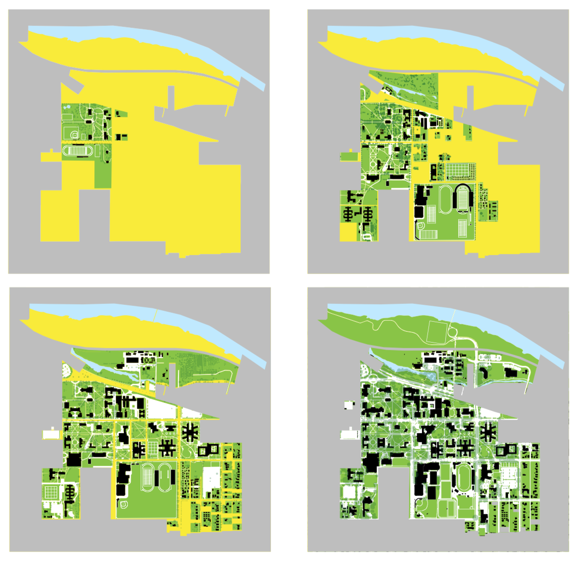
Tracking changes with aerial photography
Combining GIS files with Adobe software
Tracking the expansion of the University of Oregon Campus through 4 time periods
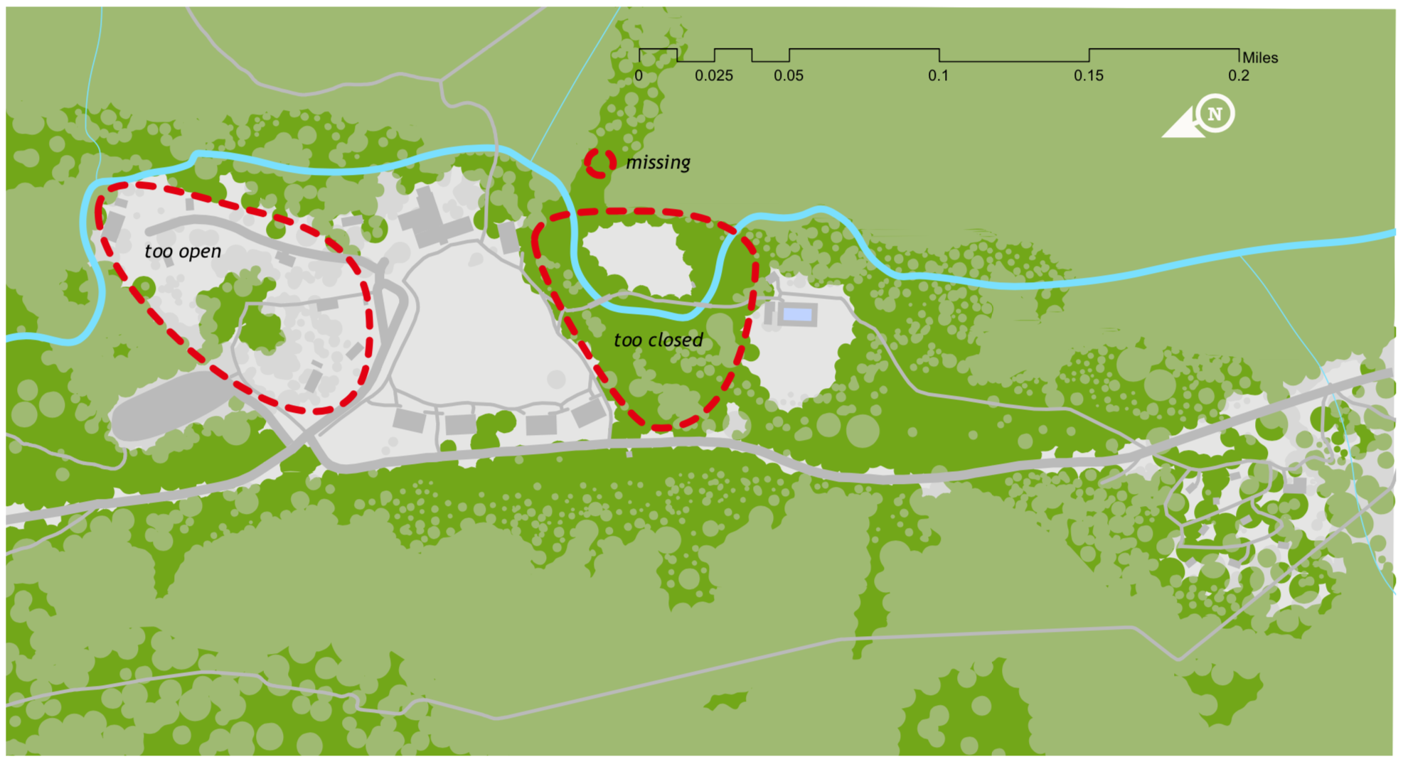
Developing treatment guidelines from aerial photography and GIS files
About
Portfolio
Projects
Contact
Share this:
Share on X (Opens in new window)
X
Share on Facebook (Opens in new window)
Facebook
Email a link to a friend (Opens in new window)
Email
Share on Pinterest (Opens in new window)
Pinterest
Like
Loading…
Loading Comments...
Write a Comment...
Email (Required)
Name (Required)
Website
Subscribe
Subscribed
LandSight
Sign me up
Already have a WordPress.com account?
Log in now.
LandSight
Subscribe
Subscribed
Sign up
Log in
Copy shortlink
Report this content
View post in Reader
Manage subscriptions
Collapse this bar
%d